2020 Executive Briefing
 BRIEFING HIGHLIGHTS
- State DOTs are deploying UAS to improve safety and collect data more efficiently.
- FHWA is promoting the adoption of UAS under their EDC-5 Program for 2019-2020.
- In video, New Jersey DOT (NJDOT) demonstrates how they have become a national leader in UAS technologies.
Introduction
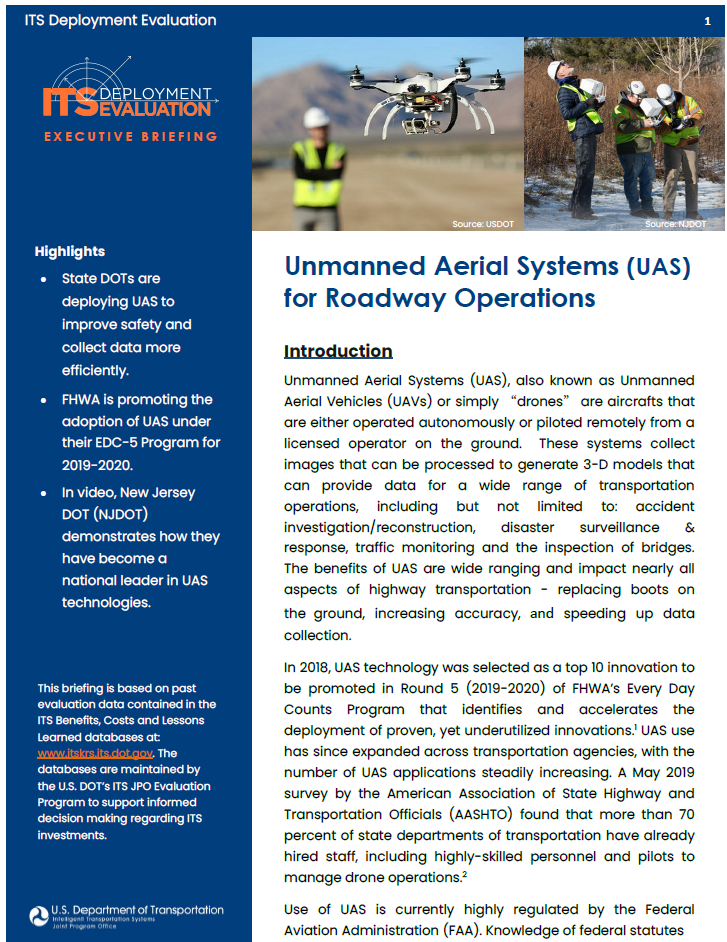
Unmanned Aerial Systems (UAS), also known as Unmanned Aerial Vehicles (UAVs) or simply “drones” are aircrafts that are either operated autonomously or piloted remotely from a licensed operator on the ground. These systems collect images that can be processed to generate 3-D models that can provide data for a wide range of transportation operations, including but not limited to: accident investigation/reconstruction, disaster surveillance & response, traffic monitoring and the inspection of bridges. The benefits of UAS are wide ranging and impact nearly all aspects of highway transportation - replacing boots on the ground, increasing accuracy, and speeding up data collection.
In 2018, UAS technology was selected as a top 10 innovation to be promoted in Round 5 (2019-2020) of FHWA’s Every Day Counts Program that identifies and accelerates the deployment of proven, yet underutilized innovations.1 UAS use has since expanded across transportation agencies, with the number of UAS applications steadily increasing. A May 2019 survey by the American Association of State Highway and Transportation Officials (AASHTO) found that more than 70 percent of state departments of transportation have already hired staff, including highly-skilled personnel and pilots to manage drone operations.2
Use of UAS is currently highly regulated by the Federal Aviation Administration (FAA). Knowledge of federal statutes and regulations related to UAS (including aircraft requirements and operational limitations) is an essential starting point for agencies wanting to conduct their own drone operations. The FAA provides resources and information to help guide UAS operators in determining which laws, rules, and regulations apply to a particular UAS operation. For more information, please see https://www.faa.gov/uas/.
Benefits
Safety. Keeping workers out of harm’s way is a major benefit of using UAS. For example, traditional bridge inspection requires setting up temporary work zones, detouring traffic, and using special equipment or even climbing. UAS technology can speed data collection while reducing risk to work crews and the traveling public.1
Accelerated Construction. UAS technology operations, such as survey or aerial photography, and facilitate exact quantity calculation and efficient payment to contractors. It can be used for routine inspections, such as flying a programmed path over silt fencing after a rain event to check for sediment buildup, and high-risk inspections, such as crane or falsework construction.1
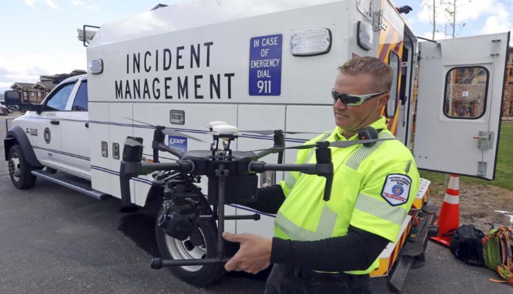
Asset Maintenance & Emergency Response. The ability to routinely and consistently map terrain and monitor condition offers the potential for isolating problem areas before an emergency occurs, which can save lives and reduce asset maintenance costs. During an emergency event, UAS technology can quickly and inexpensively survey the damage, allowing for better-informed and efficient recovery operations.1
Traffic Management. The viewing range of arterial traffic cameras is limited by intersection configuration and the camera mounting height. UAS have the potential to provide a cost-effective means to achieve a "bird's eye view'' and enable real-time coverage and rapid response for a wide array of traffic management applications.
| Agency/Location | UAS Use | Benefit |
| North Carolina State Highway Patrol (Asheville, NC) | To document and reconstruct serious accidents to unblock roads faster. | Reduced time spent mapping the accident scene from 2 hours to 25 minutes. (2018-01258) |
| Michigan Department of Transportation (MDOT) | To inspect the deck portion of a four-lane divided highway bridge with two-way traffic. | Reduced inspection cost from $4,600 to $250. (2018-01305) |
| Washington State Police (DuPont, Washington) | To gather the evidence needed to clear the roadway and resume normal traffic after an Amtrak train derailed onto a major highway | Reduced police on-scene processing time by up to 80 percent (compared to traditional methods). (2019-01389) |
| Minnesota Department of Transportation (MnDOT) | To inspect 39 bridges of a wide range of sizes, types, and locations. | Produced significant cost savings ranging from $540 to $21,000, with an overall average cost savings of 40 percent. (2019-01369) |
Costs
In a national scan of successful approaches for the use of UAS by surface transportation agencies, the National Cooperative Highway Research Program found that state transportation agencies were able to purchase sUAS (small unmanned aerial systems) with standard high-quality imagery and HD video for as little as $1,500 to $2,500.3 Being able to obtain a UAS at a reasonable entry price point allowed many agencies to justify greater use and expansion by demonstrating benefits. Other programs partnered with universities and other entities conducting research to obtain grants to purchase a UAS and sensors to further evaluate their benefits. In their personal experience, MnDOT reported that Inspection-specific drones equipped with state-of-the-art imaging devices cost anywhere from $15,000 to $40,000 to purchase and $300 to rent – as opposed to Under Bridge Inspection vehicles that cost between $500,000 and $1,000,000 to purchase or $3,000/day to rent (2020-00448).
Since 2015, MnDOT’s Bridge Office has conducted research on the use of UAS for bridge inspections using a multi-phased approach. In the first research phase, researchers established the value of using UAS for such inspections. In the next phase, they tested a commercial inspection-specific drone with improved infrared and video capability and increased operational flexibility on larger and more complex structures. Phase III research focused on exploring the use of a collision-tolerant UAS for confined spaces. Currently, MnDOT is in Phase IV of their UAS implementation plan, which involves performing cost-benefit analyses to calculate the cost-effectiveness of UAS for bridge inspections. During Phase II, the implementation team produced the following recommendations from their experiences (2019-00912).
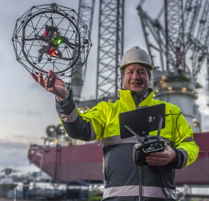
Figure 3. A drone designed with a cage to prevent collision. Source: Flyability For restrictive locations, collision-tolerant UAS are the most cost-effective option. The study identified that there are many areas within bridge inspection that are prohibitive for imaging using a larger mapping UAS, including the interior of tub girders; culverts, pipes, or tunnels; and high wall abutments.
- Suspect deficiencies or areas should be followed up with a hands-on inspection. The study demonstrated that focus should be on the inspector’s qualifications and their ability to determine on a case by case basis if the image quality is enough to determine with certainty the structural condition of the bridge element that is being inspected. In many cases, suspect deficiencies or areas must be followed up with a hands-on inspection. This is especially true when an inspector feels the need to use manual tools such as a hammer for sounding.
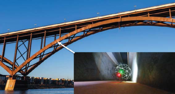
Figure 4: One type of drone MnDOT bridge inspectors used flies within a cage that can roll in confined spaces, preventing collision damage. Source: MnDOT Inspectors are encouraged to use terrestrial photographs (photographs taken from the ground) in conjunction with aerial photographs to create high-resolution images and models. In conjunction with aerial photographs, terrestrial photographs can provide a more comprehensive model as the final deliverable. The processing software was found to work best when images were taken in a smooth continuous path with approximately 75 percent overlap.
- Models should include scales and/or ground control points (GCP) to ensure accuracy in the measurement of defects. Using GPS, a drone will place the model into the correct global position within several feet which is generally good enough for inspection purposes. The use of ground control points can add absolute accuracy and place the inspection model in the exact global position. These coordinates can be included in the model so when processed, the absolute accuracy can be set to as precise as millimeters.
- Cloud-based platforms should be used to clearly communicate inspection results. Performing bridge inspections with drones typically generates large amounts of data that can be difficult to share with bridge owners and decision makers. Using a cloud interface, a bridge engineer or owner can view the inspection data in 3D models without having to download and store large amounts of data.
- The imaging field of view must face vertically and the device should have the ability to fly without the need for a GPS signal. The study exposed that the imaging field of view must face vertically to allow for inspection of members above the UAS such as deck soffit and interior beams. Additionally, the ability to fly without the need for a GPS signal is critical when operating under a structure or in confined spaces.
Case Study
NJDOT UAS Initiatives:
|
In 2017, New Jersey DOT (NJDOT) became one of the first state DOTs to establish a drone program and has since become a national leader in UAS. To get their drone program off the ground, NJDOT quickly created a UAS Coordinator position within the Division of Multi-Modal’s Bureau of Aeronautics that would lead NJDOT’s UAS initiatives.4
Funding was the next big hurdle for the new program. NJDOT successfully applied for three FHWA grants, including:4
- FHWA Tech Transfer Deployment Funds to hold a UAS Peer Exchange on Best Practices. A national UAS Peer Exchange was held based on the successful NJ model and NJDOT’s UAS Coordinator presented at the event in Washington DC.
- FHWA State Transportation Innovation Council (STIC) Incentive Program Funding to purchase equipment and training to evaluate the use of UAS.
- FHWA State Planning & Research Program funds for research into Best Practices, Policies and Procedures to recommend potential legislative and regulatory remedies, enforcement and compliance strategies and tools, and training products for engineers and consultants involved in UAS operations.
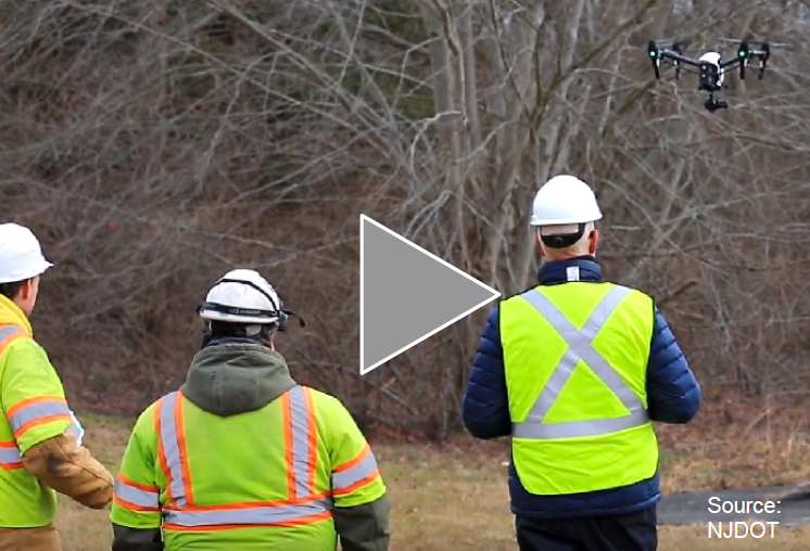
NJDOT has since integrated UAS into many transportation research and field studies. In 2019 after the kick-off of EDC-5, NJDOT developed a protocol to utilize the SimpliGov online system to streamline requests for UAS usage on projects. The agency also developed an internal Night Training Course to fulfill the FAA Certificate of Waiver or Authorization (COA) requirements, helping to support future requests for NJDOT UAS operations at night. Additionally, the agency created an interactive UAS display for "Take Your Child to Work Day" to promote staff and youth education of the program's work. Funds were also used to create a NJDOT UAS Program video highlighting the innovation and benefits of the program for the state (see right).4
NJDOT pursued and received STIC Incentive Funding to further build the capacity of the UAS Program. Through investments in equipment and training, New Jersey foresees UAS contributing to innovations through enhanced processing capability for 3D models, advanced training courses for photogrammetry, aerial photography and videography, and, thermal imaging capability for watershed surveys and wildlife counts under bridges, among other activities.4
References
- Gray, J.; Yew, C. Unmanned Aerial Systems (UAS) Factsheet. FHWA Every Day Counts Program. January 2019. https://www.fhwa.dot.gov/innovation/everydaycounts/edc_5/docs/uasfactsheet.pdf
- 2019 AASHTO UAS/Drone Survey of All 50 State DOTs. AASHTO. May 2019. https://www.transportation.org/wp-content/uploads/2019/05/MissionControl_Drones3.pdf
- Successful Approaches for the Use of Unmanned Aerial System by Surface Transportation Agencies. Prepared for National Cooperative Highway Research Program. July 2018. http://onlinepubs.trb.org/onlinepubs/nchrp/docs/NCHRP20-68A_17-01.pdf
- Unmanned Aerial Systems. NJDOT Technology Transfer. https://www.njdottechtransfer.net/uas/


