Oregon DOT Asset Management System Expected to Deliver Approximately $3.4 Million in Tangible Benefits.
The Oregon DOT Implements Two Programs to Create Feasible Asset Management for Oregon’s Roadway Infrastructure.
Statewide, Oregon, United States
Oregon DOT builds information system on asset management software
Summary Information
To improve roadway asset management and eliminate data duplication, the Oregon Department of Transportation (ODOT) implemented two integrated programs: TransInfo and the FACS-STIP Tool. TransInfo, built on the AssetWise platform, unifies disparate asset data, maintains spatial accuracy, and supports inventory, maintenance, and reporting needs. It includes the Transportation Intelligence Gateway (TIG) for advanced analytics and dynamic reporting. The FACS-STIP Tool complements this by providing web-based access to asset location, condition, and attributes via interactive maps and reports. Together, these tools streamline asset management and enhance data-driven decision-making across ODOT.
Methodology
ODOT created TransInfo to reconcile and connect disparate asset data, maintain a spatial representation of all information, and integrate all network assets and asset information systems. The program allows the agency to model and manage data in an efficient manner for transactional data collection and maintenance. Under Transinfo, it is easier to generate accurate reports and support Governmental Accounting Standards Board Standard 34 for asset reporting. All information and data are easily available to ODOT and all other consumers.
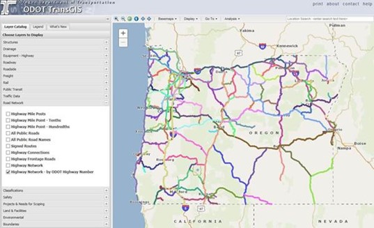
The FACS-STIP Tool is designed for external users to have access to statewide asset management data and spatial mapping functions. FACS-STIP serves as the single location for users to access asset information stored at ODOT. The solution is a GIS implementation with a map-based user interface. Analysis and data management tools appear in a simple, one-menu user interface design.
Accessing all asset data through a single, uniform asset management system enabled the following benefits:
- The new statewide asset management system is expected to deliver approximately $3.4 million in tangible benefits, as well as many intangible ones. For example, the system has streamlined data entry and reporting, enhanced data accuracy and available detail, reduced risk of errors, cut training time and improved safety.
- Reduced time to enter construction-planning information by 15 percent and labor costs related to data collection, entry, and maintenance by 10 percent.
- Realized a 66 percent increase in overall efficiency compared to when the other systems were used.
- Using the mobile collection portion of the FACS-STIP Tool allows for maintenance crews to collect data electronically using mobile devices, eliminating the use of hard copies.
Abbreviations:
- FACT-STIP: Features, Attributes and Conditions Survey - Statewide Transportation Improvement Program